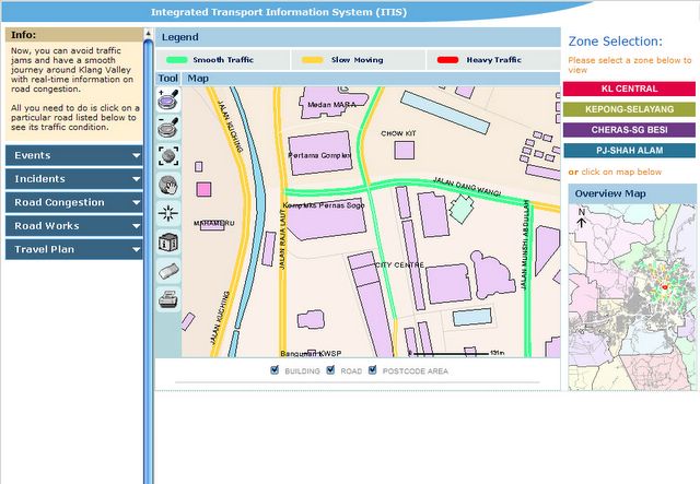
You can basically zoom in and pan to check out the routes to see the condition of the traffic in colour form. The map is surprisingly quite detail with all the main landmarks in place.

While, what you should be looking for is traffic situation, you can also use this as a map. I think this is a good effort by the city council but I think this project should be spread to other states such as Penang and Johore which is also famous for their bad traffic condition during peak hours.
If you are interested, do drop by at http://www.itis.com.my

2 comments:
err... i tried and found:
The requested URL could not be retrieved
maybe they have some other links?
I can't access it now either! The DNS server could be down or perhaps their server is down. Try again tomorrow but I'm sure the URL is correct.
Post a Comment